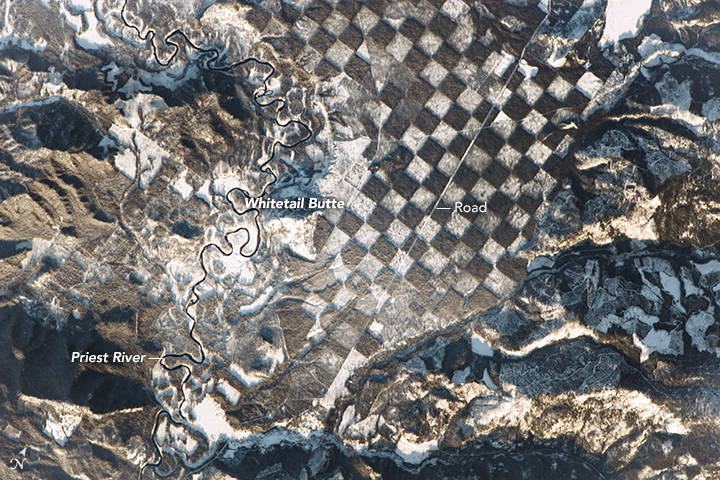
Idaho’s natural environment is famous for many things, including breathtaking beauty and fascinating wildlife, but perfect geometry isn’t among them. That’s why this photo of a forest area along Priest River taken from the International Space Station has been getting a lot of attention online.
In January of 2017, astronauts aboard the International Space Station shared a picture of what resembled a near-perfect chessboard pattern located in an area around Whitetail Butte in northern Idaho’s Bonner County. Apparently, the squares in this landscape are the result of a forest management technique dating back to the 1800s, where alternate one-square-mile parcels of land were granted to the US Government to the US Railroad and various other companies. This method ensured the sustainability of forest areas while also enabling logging operations.


